Data Water and Climate
The Mountain is the refuge
We are the climate refuge of South America
By Violeta Ayala — Tecnóloga Creativa
Water and climate series · Part 1 of 3
1. The mountain is the refuge · 2. Water is the condition · 3. Mineral, compute and water
The Andes will be one of the few places in South America where the human body can still function by the end of this century. That is physics and it is well established. The part almost nobody discusses is the other one: the water that sustains those mountains has been declining for forty years.
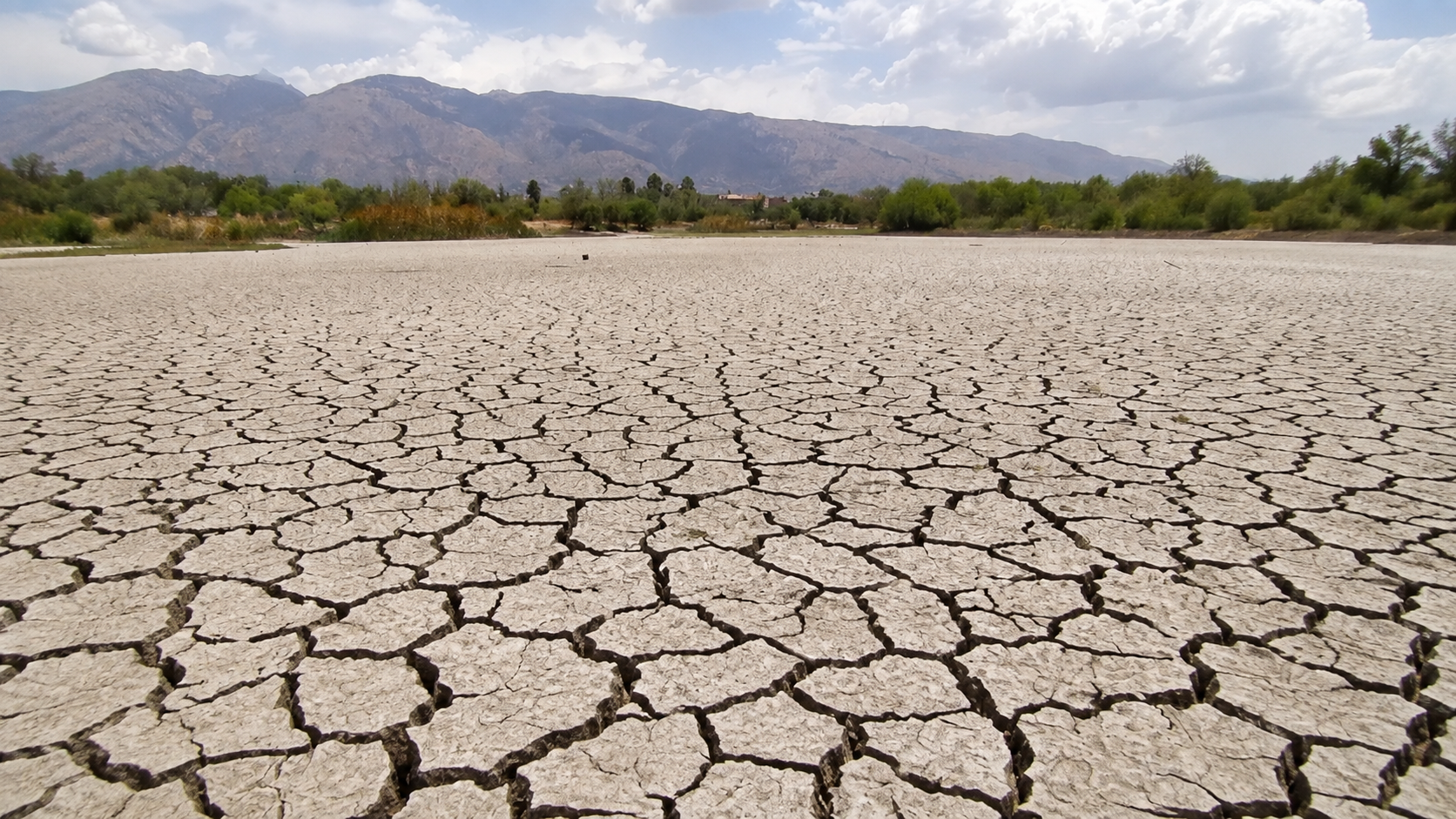
On 31 July 2026 the municipality of Yotala, in Chuquisaca, declared extreme drought. Mayor Sabino Albarracín asked for water to be trucked in to guarantee human consumption. Yotala sits at 2,500 metres, above the Cachimayu river, in the middle of the cordillera.
Altitude protects you from lethal heat. It does not hand you a glass of water.
Why altitude saves
Air temperature drops about 6.5 degrees per thousand metres. Cochabamba, at 2,560 metres, starts around 16 degrees cooler than a point at the same latitude at sea level. Santa Cruz, at 400 metres, has no such cushion.
And something matters more than heat alone. What kills is the combination of heat and humidity, measured as . Above a certain value, sweat stops evaporating, the body loses its only cooling mechanism and a healthy person dies within hours. No air conditioning helps without electricity.
Cold air holds far less water vapour. That is why sweat still works at altitude and wet bulb never reaches lethal values there. The cordillera is a thermal refuge, and it works through basic atmospheric physics.
People already living outside the . Under current policies, which lead to 2.7 degrees of warming, between 22 and 39 percent of humanity would fall outside it by the end of the century.
The maps in that study mark northern South America, much of Africa, the southern United States and India in red. The Andes appear green. Bolivia is split in two: the altiplano and the valleys inside the refuge, the eastern lowlands outside it.
Why altitude also loses
Mountains warm faster than lowlands. It is called elevation-dependent warming and it has been measured.
A review in Nature Reviews Earth and Environment found that between 1980 and 2020 mountain regions warmed 0.21 degrees per century faster than neighbouring lowlands, with less rain and less snow at the same time. In the Andes specifically, a study using MODIS satellite imagery found winter surface temperature rising 0.5 degrees per decade between one thousand and fifteen hundred metres, and 1.7 degrees per decade above five thousand metres.
Three times faster up high than down low. And up high is exactly where the ice is.
Peak water already passed
This is the central finding of the whole investigation and almost nobody says it out loud.
When a glacier melts, it first delivers more water. The river grows. Then, once the ice shrinks enough, it delivers less, and keeps declining toward zero. That maximum point is called .
According to the UNESCO Atlas of Andean Glaciers and Water, many glaciers in the tropical Andes reached peak water in the 1980s.
Meltwater has been declining since before many of us were born. This is not a future threat. It is a forty year downward curve we are already standing on. What comes next is the steep part.
Timeline of Andean water
Tap a year.
How much each city depends
In a normal year the glacier contributes little. In a drought year, which is when it matters, the contribution spikes because it is the only thing still running. The UNESCO Atlas measured that maximum monthly contribution in dry years for several Andean cities.
Glacier contribution in a drought year
Tap a city.
La Paz and El Alto are Bolivia's extreme case. In drought, most of the water coming out of the tap comes from ice that is running out. The crisis of November 2016, with rationing by neighbourhood for weeks, was the dress rehearsal.
Bolivia holds twenty percent of the region's tropical glaciers, second after Peru. Chacaltaya went extinct in 2009. Peru lost 140 glaciers between 2000 and 2016, the Ayacucho region lost its entire glacier cover, and projections give up to eighty percent national loss by 2100. In Colombia, the Los Cerros de la Plaza glacier finished disappearing this year.
And the rain, where does it come from?
Cochabamba's water is not born in a local cloud. It is born in the Atlantic, recycled over the Amazon, crashes into the Andes and rises. If that conveyor belt breaks down, the reservoir does not fill no matter how much vapour the planet holds.
The route. Moist air enters from the Atlantic, crosses the Amazon recycling several times through evapotranspiration, hits the Andean wall, cannot pass and turns south forming the South American low-level jet. That jet brings rain to Bolivia's eastern lowlands and valleys.
There will be more vapour, not less
For every degree of warming, air holds around seven percent more moisture. That is hard physics, no uncertainty. The planet has more water in the atmosphere.
More vapour does not mean more rain where you need it. It means the same annual amount falling on fewer days, harder.
The conveyor belt breaks down
Models project that northward trade winds weaken, reducing moisture transported to northern Brazil, which affects the flux feeding the low-level jet. In parallel, the Amazon dry season lengthens and monsoon onset is delayed.
Hot air is harder to break
This mechanism is barely mentioned and it is the harshest. In a warmer, more humid and more stable climate, the threshold needed to trigger convection rises, and that, combined with circulation changes, can weaken the onset of the rainy season.
There is more moisture loaded and it costs more to make it fall. When it finally breaks, it dumps everything at once. Hail, flash flood, and nothing the following week.
The forest manufactures its own rain
Rain over tropical South America releases latent heat that strengthens the thermal gradient between ocean and continent, and that intensifies the inflow of moist air into the basin. It is a loop: the forest generates the rain that generates the forest.
If deforestation breaks that loop, the low-level jet weakens for lack of latent heat. The fires in Beni and Santa Cruz are not an environmental problem over there. They are a water problem over here.
And the freezing line rises
What falls as snow in the cordillera today will fall as rain. Snow is stored for months and released slowly. Rain runs off the same day. Even if the annual total does not change, the system loses its ability to store.
The problem stops being volume and becomes timing. And that changes entirely what needs to be built.
Part 2 Water is the condition. Cochabamba has a full reservoir and neighbourhoods buying water by the truckload.Sources and research
- UNESCO. Atlas of Andean Glaciers and Water. Peak water in the tropical Andes and glacier contribution in dry years by city.
https://www.unesco.org/es - Nature Reviews Earth and Environment. Review of elevation-dependent warming in mountain regions, 1980 to 2020.
- Nature Sustainability. Quantifying the human cost of global warming. Human climate niche and exposed population.
- Environmental Research: Climate. South American monsoon lifecycle under warming scenarios, 2026.
https://iopscience.iop.org/article/10.1088/2752-5295/ae42df - International Journal of Climatology. Projections of Atmospheric Moisture Transport Over South America in a Changing Climate, 2026.
https://rmets.onlinelibrary.wiley.com/doi/full/10.1002/joc.70207 - Scientific Reports. A deforestation-induced tipping point for the South American monsoon system.
https://www.nature.com/articles/srep41489 - Climatic Change. CMIP3 projected changes in the annual cycle of the South American Monsoon. Convection threshold in a warmer climate.
https://link.springer.com/article/10.1007/s10584-009-9736-6 - Asociación de Ingenieros Eméritos de Cochabamba / CEDIB. Water situation in Cochabamba. Foro del Sur, May 2016, twenty years after the Water War. Network losses, wells and abandoned works. In Spanish.
https://www.cedib.org/wp-content/uploads/2016/05/FORO-DEL-SUR..AGUA-2016...CBBA_.pdf - Ramoneda Martí, A. (2019). Water management as a commons in the municipality of Cochabamba, Bolivia. 19 years after the Water War. Anuario del Conflicto Social, no. 8. In Spanish.
https://revistes.ub.edu/index.php/ACS/article/view/ACS2019.8.10 - Repositorio Digital UMSS. Documentation on water management in the Cochabamba valley. Universidad Mayor de San Simón. In Spanish.
http://ddigital.umss.edu.bo/handle/123456789/55466 - El Deber (28 de junio de 2026). Gobierno entrega proyecto de agua que beneficiará a más de 24.000 familias del sur de Cochabamba. Interconexión JICA.
https://eldeber.com.bo/pais/gobierno-entrega-proyecto-agua-beneficiara-24-000-familias-sur-cochabamba_1782666558 - Agencia de Noticias Fides (31 de julio de 2026). Yotala enfrenta una sequía extrema y urge el traslado de agua para consumo humano.
https://www.noticiasfides.com/ - Aquafondo y SUNASS. Monitoreo de amunas en Huarochirí y guía metodológica de siembra y cosecha de agua.
- Ciudatos Bolivia and Lab TecnoSocial (2023). How Bolivia became an urban and unequal country. Written and visualised by Valeria Peredo. Life expectancy gap between northern and southern Cochabamba. In Spanish.
https://ciudatoslab.github.io/urbanizacion-en-bolivia/
https://github.com/ciudatoslab/urbanizacion-en-bolivia - Empresa Misicuni. Reservoir data, flow rates and project phases, 2025 and 2026. In Spanish.
https://www.misicuni.gob.bo/
Share
Link copied.